In a world where digital navigation tools can pinpoint your location within seconds, the charm and wonder of vintage cartography remain undiminished. These historical maps, crafted with precision, artistry, and imagination, tell stories far beyond geographical data. They are artifacts of exploration, expressions of cultural identity, and windows into the minds of those who shaped our understanding of the world. Vintage cartography is not merely a relic of the past—it is a treasure trove of historical significance, artistic beauty, and timeless curiosity.
A Journey Through Time: The Origins of Cartography
The roots of cartography can be traced back thousands of years, long before the invention of GPS or satellite imagery. Ancient civilizations like the Babylonians, Egyptians, and Greeks drew rudimentary maps to depict their known world. These early maps were often symbolic, mixing geography with mythology and cosmology. The purpose wasn’t just to navigate but to explain the universe and humanity’s place within it.
The Greeks made significant contributions to cartography with scholars like Anaximander and Ptolemy. Ptolemy’s work, especially his book Geographia, laid the foundation for mapmaking for centuries. His methods of using coordinates and projecting a spherical Earth onto a flat surface were revolutionary, influencing mapmakers well into the Renaissance.
The Medieval View: Mappa Mundi and Religious Symbolism
During the Middle Ages, European cartography took on a distinctly religious tone. The mappa mundi—medieval European maps of the world—were more theological than geographical. These maps, such as the Hereford Mappa Mundi, placed Jerusalem at the center and depicted biblical events, paradise, and monsters alongside real and imagined lands.
Rather than serving practical navigational purposes, these maps were visual expressions of spiritual beliefs and moral teachings. Despite their inaccuracies by modern standards, they offer a fascinating glimpse into the medieval mindset and worldview.
The Age of Discovery: Expanding the World
The 15th and 16th centuries marked a transformative period in cartography, fueled by the Age of Exploration. European explorers set sail across uncharted oceans, returning with detailed accounts and sketches of new lands. Mapmakers, or cartographers, eagerly compiled this new information into increasingly accurate representations of the world.
This era gave rise to some of the most iconic vintage maps, created by figures like Gerardus Mercator and Abraham Ortelius. Mercator’s 1569 world map introduced a projection that preserved navigational angles, making it invaluable for seafaring despite its distortion of landmasses near the poles. Ortelius, meanwhile, published the first modern atlas, Theatrum Orbis Terrarum, combining cartographic knowledge with artistic flair.
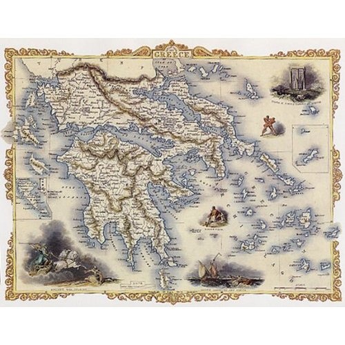
Maps from this period were often richly decorated with elaborate borders, sea monsters, compass roses, and ships, turning them into works of art as much as tools for travel. These embellishments not only served aesthetic purposes but also communicated the dangers and mysteries of uncharted territories.
Cultural Reflections and Imperial Power
Vintage maps do more than chart geography—they reflect the values, ambitions, and biases of their creators. During the colonial era, maps became instruments of imperial power. European empires used cartography to assert control over vast territories, often redrawing boundaries to suit political agendas.
These maps frequently exaggerated the importance of certain regions while minimizing or omitting others, subtly shaping perceptions of dominance and subordination. For instance, colonial powers like Britain and Spain produced maps that prominently featured their colonies, reinforcing their geopolitical influence.
Despite these biases, vintage maps offer an invaluable record of historical developments, trade routes, and cross-cultural encounters. They chart not only the earth’s contours but also the complex relationships between people, places, and power.
The Artistry of Antique Maps
One of the most captivating aspects of vintage cartography is its artistry. Unlike modern maps, which prioritize functionality and uniformity, antique maps were often handcrafted masterpieces. Cartographers combined scientific knowledge with artistic skills, creating maps that were both informative and visually stunning.
These maps were frequently printed using copperplate engraving and then hand-colored. The result was a unique blend of precision and individuality. Decorative elements like allegorical figures, coats of arms, mythological creatures, and portraits of explorers added layers of meaning and intrigue.
Each map was a labor of love, often taking months or even years to complete. The meticulous craftsmanship speaks to a time when cartography was as much about storytelling and aesthetics as it was about accuracy.
The Rise of Thematic Maps
As scientific knowledge advanced during the Enlightenment and beyond, cartography expanded beyond geographic representation. Thematic maps emerged, focusing on specific subjects like population, climate, trade, and disease. These maps provided new insights into the human and natural world, paving the way for modern data visualization.
Vintage thematic maps, such as John Snow’s cholera map of London or Charles Joseph Minard’s depiction of Napoleon’s Russian campaign, are celebrated not only for their historical importance but also for their innovative use of visual storytelling. They demonstrate how maps can be powerful tools for understanding complex information.
Collecting Vintage Maps: A Window into the Past
Today, vintage maps are highly sought after by collectors, historians, and enthusiasts. Each map holds a unique story, whether it’s a rare 17th-century globe or a colonial-era city plan. Collectors value these items for their historical significance, artistic merit, and rarity.
Auction houses, antique shops, and specialized dealers offer a wide range of vintage maps, from affordable prints to museum-quality originals. Some collectors focus on specific regions, time periods, or cartographers, while others are drawn to maps that evoke personal connections or evoke curiosity about forgotten places.
Restoration and preservation are important aspects of collecting, as many old maps are fragile and susceptible to damage. Professional conservation helps maintain their integrity, ensuring that these historical documents can be appreciated by future generations.
Digital Renaissance: Rediscovering Old Maps Online
In recent years, the digital age has brought a renaissance in vintage cartography. Libraries, universities, and archives around the world have digitized their map collections, making them accessible to anyone with an internet connection. These digital archives have opened up new possibilities for research, education, and appreciation.
Online platforms allow users to explore maps in high resolution, zoom in on intricate details, and compare different editions side by side. Some digital tools even overlay old maps onto modern geography, revealing how cities and landscapes have changed over time.
This digital revival has not only preserved vintage maps but also sparked renewed interest in their historical, cultural, and artistic value. Students, scholars, and curious minds alike can now journey through time without leaving their homes.
The Timeless Appeal of Vintage Cartography
What makes vintage cartography so enduringly fascinating? Perhaps it’s the combination of science and art, or the way each map tells a story that is both personal and universal. Maybe it’s the sense of mystery and adventure, the idea that beyond the edge of the map lies the unknown.
Vintage maps remind us of a time when the world was still being discovered, when every new voyage held the promise of revelation. They are testaments to human curiosity, creativity, and the desire to make sense of the world.
In an age of rapid technological change, vintage maps offer a grounding presence—a reminder of where we’ve come from and how our understanding of the world has evolved. They challenge us to look deeper, think critically, and appreciate the layers of meaning that can be hidden within a seemingly simple image.
Conclusion: Charting New Paths with Old Maps
Vintage cartography is more than a historical curiosity—it is a living legacy. From ancient scrolls to gilded atlases, these maps continue to inspire wonder, provoke thought, and ignite the imagination. Whether displayed in a gallery, studied in a classroom, or cherished in a private collection, vintage maps bridge the gap between past and present.
They invite us to explore not only the world as it was known but also the minds and cultures that shaped that knowledge. And in doing so, they map out not just places, but the very human spirit of discovery.